Déry, Stephen
Person Preferred Name
Stephen Déry
Related Works
Content type
Digital Document
Description / Synopsis
This research aims to enhance scholarly understanding of snow dynamics, the remotely sensed snowpacks, and the calculation of basin-wide snow water equivalent in mountainous terrain. Mountain snow is a critical source of meltwater. However, forecasting snow distributions and total water equivalence in mountain basins is limited due to complex terrain, challenging environmental conditions, and lack of observations. Laser altimetry can provide detailed observations of snow depth, but an estimate of snow density is required to evaluate the total basin water equivalence. This study uses laser altimetry surveys and empirically modelled snow densities to estimate mountainous basin-wide snow-water equivalent (SWE). Between 2017 and 2020, seven laser altimeter surveys during late winter and spring were conducted in the LaJoie Basin, Coast Mountains, British Columbia (B.C.), a strategic hydroelectric power reservoir. The laser-derived snow depths averaged between 1.4 and 2.1 m for non-glacierized terrain, while glacierized terrain weighted averages ranged between 2.2 and 5.4 m. The laser-derived depths were combined with empirical snow density models to derive distributed SWE for the Lajoie Basin. Ten linear and three non-linear snow density empirical models were tested and developed, from which (a) a snow course multi-parameter, non-linear relation and (b) snow pillow robust (Huber loss) linear regressions yielded this study’s lowest root mean squared errors (51.65 and 74.12 kg m-3, respectively). For non-glacierized terrain, the multi-parameter, non-linear model produced basin-wide SWE averages between 0.56 and 1.06 m.w.e. and propagated uncertainties from ± 0.1 to ± 0.14 m.w.e. Conversely, glacierized terrain exhibited weighted SWE averages between 0.82 and 2.93 m.w.e., with estimates of uncertainty ranging from ± 0.31 to ± 0.52 m.w.e. The robust linear regressions yielded non-glacierized SWE averages from 0.49 to 0.92 m.w.e., with uncertainties between ± 0.14 and ± 0.2 m.w.e. The weighted SWE averages in glacierized terrain ranged between 0.77 and 1.92 m.w.e., with estimates of uncertainty between ± 0.29 and ± 0.45 m.w.e. The SWE estimates from lidar and modelled density are comparable to snow pillow observations at the watershed, which demonstrates the effectiveness of these coupled techniques and improves our forecasting capabilities.
Origin Information
Content type
Digital Document
Origin Information
Content type
Digital Document
Description / Synopsis
This project examines precipitation patterns across the Continental Divide in the southern Canadian Rockies with a focus on precipitation gradients. This thesis is part of the Storms and Precipitation Across the continental Divide Experiment (SPADE) that occurred between 26 April 2019 and 26 June 2019. Daily meteorological data were also examined between 2011 and 2019. The study area encompassed mountainous topography from the Columbia Valley in eastern British Columbia, to a transect of stations alongside the Foothills in western Alberta, with a range of elevations from about 750 m to about 3500 m above sea level. Local station data were derived from three meteorological stations developed for the SPADE campaign, Nipika Mountain Resort (Nipika), Fortress Junction, Fortress Mountain and a tipping bucket transect. Regional station data were derived from several meteorological station networks with publicly available data. Gridded data included ERA5 and ERA5-Land. Cumulative precipitation amounts were the focus of this study, but temperature, relative humidity, and wind speed and direction were also included in my analysis. The objectives of this project are to examine relationships between precipitation gradients/patterns and elevation, cool and warm seasons, general wind patterns/storm trajectories, and inter-annual and intra-annual variability. Elevation is a predictor of precipitation amounts in our study region, and over most time-frames it was a stronger predictor than latitude and longitude in determining precipitation amounts, but the relationship between elevation and precipitation was not always significant. On average precipitation increases at a rate of 0.39 mm m-1 across the study region when it is examined across an annual period. Warm (summer) and cool (winter) seasons exhibited distinctly different precipitation gradients. A southerly wind component at Nipika was associated with large amounts of precipitation at this site.
Origin Information
Content type
Digital Document
Description / Synopsis
Alpine snow is an important water reservoir for mountain hydrology, climate, ecosystem functions, and has substantial economic value. Snowmelt during spring and summer is driven primarily by incoming shortwave and longwave radiation fluxes, and the ground heat flux is considered to be negligible during this time. However, during the accumulation phase, the ground heat flux may contribute to snowpack thermal conditions and midwinter melt, though this subject has not been studied extensively. The objective of this study is to quantify the alpine ground thermal regime and its relation to topographic setting and the overlying snowpack. The effects of elevation, maximum winter snow depth, snow cover duration, slope, ruggedness, aspect, total potential solar radiation, proximity to glacial ice, and depth of thermistor were evaluated. Four transects consisting of 29 temperature data loggers at the ground-snow interface and one meteorological station collected data from 16 August 2020 to 6 August 2021 at an alpine site in the Purcell Mountains in British Columbia. Snow cover duration, onset, and end-of-winter depths were found to have the greatest influence on the ground thermal regime. Total potential solar radiation had an inverted relation with ground temperatures, however, this was likely related to snow cover duration. Modeled ground heat flux scenarios revealed that snow depth or onset is the most influential of the variables tested. Snow thermal conductivity has the second greatest influence on total ground heat flux, however, true snow thermal conductivity likely varies throughout the winter season and was not measured in this study. Wind has the greatest influence on snow distribution within the Conrad basin with wind scoured slopes coincidentally sharing the same aspect as slopes that receive the greatest total potential solar radiation. There is little evidence to suggest that the ground thermal regime has any influence over the overlying snowpack.
Origin Information
Content type
Digital Document
Description / Synopsis
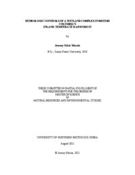
Ancient Forest/Chun T’Oh Whudujut Provincial Park (AFP) is part of British Columbia’s (BC) inland temperate rainforest that receives high total annual precipitation amounts (>1000 mm) from orographic enhancement. AFP hosts a ~4 km2 complex of valley bottom wetlands which is supported by this precipitation, a good portion of which falls as snow. This study examines the hydrology of the wetland complex to determine the primary water sources and their influence on flow paths and recharge. Water levels and meteorological conditions were monitored for 2019 and 2020, and water samples were collected for isotopic data during the 2020 snow free period. Kriging of water level data revealed a northeastward nearly flat hydraulic gradient that shifted orientation during wet and dry periods through the summertime. Rainfall amounts were above average at 700.2 mm and 676.4 mm while snow water equivalent varied at 762.8 mm (below average) and 1082.8 mm (above average) for 2019 and 2020, respectively. The reduced snowpack of 2019 yielded lower water levels through the summertime when compared to those of 2020. End Member Mixing Analysis (EMMA) of stable water isotope data indicates that rainfall is not a significant enough recharge source to alter the wetland groundwater composition, while snowmelt is likely the dominant source of input for the groundwater. Cross correlation between rainfall and water level data indicates however that water levels do respond to rainfall events with lag times ranging from 13 – 30 hrs. This observation leads to the conclusion that rainfall serves to flush stored snowmelt generated water from the soils into the wetland complex, though not in a significant enough volume to replace snowmelt as the dominant soil water source. Since previous research has concluded that by 2050 as much as 50 % of the current snow contribution to total annual precipitation will be replaced by rainfall, this study indicates that this shift in precipitation regime may result in lower water levels in the wetland complex. Numerical modelling of the relationship between wetland water levels and precipitation phases and amounts would improve the understanding of the climate resiliency of valley bottom wetlands in the Robson Valley.
Origin Information
Content type
Digital Document
Description / Synopsis
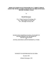
This dissertation investigates winter accumulation and snow cover change in the Columbia Mountains of British Columbia. In chapter 1, I start with an introduction that describes the study area, and then outlines the objectives and structure of this dissertation. In chapter 2, I examine the performance of two snow evolution models with different complexities (SnowModel and Alpine3D) at simulating winter glacier mass balance on four individual glaciers using two different forcing datasets, the Weather Research and Forecasting model (WRF) outputs and the North American Land Data Assimilation System (NLDAS). My results show that both models can simulate winter accumulation with less than 20% bias for each glacier, with SnowModel forced by WRF yielding the least overall bias. In chapter 3, I study the effect of wind on snow patterns to determine the impact of snow redistribution by wind in terms of erosion, deposition, and sublimation on winter mass balance estimation. The results demonstrate that modelled redistribution of snow by wind produces a visually realistic pattern of snow accumulation when compared to observed snow depth, but its impact on the glacier-averaged winter mass balance estimation is negligible (< 4%). The results also suggest that drifting snow sublimation is highly time and space dependent. Considering the model performance from previous chapters, in chapter 4, I analyzed the future snow cover change over the upper Columbia Basin under the Representative Concentration Pathway (RCP8.5) climate scenario by the end of the 21st century. I used downscaled climate projections of the Community Earth System Model (CESM1) by WRF, along with statistically downscaled data provided from the Pacific Climate Impacts Consortium (PCIC) to force SnowModel. The simulated snow maps represent a higher dynamically downscaled mean snow water equivalent (SWE) reduction – reaching up to 30% by the end of the century - than the statistically downscaled SWE reduction. While SWE reduction of more than 60% happens at lower and mid-elevations, altitudes higher than 2000 m are less vulnerable to climate change. I conclude this dissertation (Chapter 5) with a summary of the progress gained, study limitations, suggestions for future research, and research implications.
Origin Information
Content type
Digital Document
Description / Synopsis
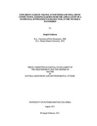
The Nechako Watershed is a large system in northern BC that exemplifies the challenge of integrating information across climate, environment and well-being. This research responded to this need with the goal of enhancing how information about the Nechako Watershed is communicated and shared. Informed by the development of a geospatial ‘portal’ tool in northern BC, this research sought to establish the Integrated Watershed Research Group (IWRG) Portal, gain insight on establishing accessible knowledge exchange strategies, and identify its perceived benefits and limitations. The research had two phases. Phase I involved working with a development team to understand this tool, testing, establishing the IWRG Portal, finding and formatting content. Phase II brought members of the Portal User Research Group together to further refine the IWRG Portal and content through scoping discussions, workshops, and a focus group. Thematic analysis was used to code and analyze the transcribed focus group. The research identified benefits of the portal with how it dealt with complexity and its integrative features. Limitations were also found, including the need for intentional framing of data, a steep learning curve, and the need for an internet connection. Analysis also identified the need to tailor content for specific audiences. The research has shown that tools such as the IWRG Portal can create new pathways to understanding and finding information. The research has also identified paths for further refinement and development of the portal tool by expanding the user base and continuing to evaluate the effectiveness of this tool in various contexts.
Origin Information
Content type
Digital Document
Description / Synopsis
It is prudent to understand how tree growth responds to climate variability to better project their growth in the current and future changes in climate in boreal forests. In this thesis, I studied how climate variables influence individual white spruce trees (Picea glauca (Moench) Voss) over short and intermediate periods in pure and mixedwood stands in northeastern British Columbia. In Chapter 2, I studied the importance and the influence of annual, seasonal, and monthly microclimate variables on the annual growth of white spruce trees in pure and mixedwood stands. In Chapter 3, I studied the importance and the influence of microclimate variables on sap flow of white spruce trees through different time scales in these two stand types. My key finding in these two chapters is that stand composition and structure are essential determinants of how spruce radial growth and sap flow respond to fluctuations in climate variables, and how they will respond to projected future climate scenarios. A combination of warmer temperatures and drought during summer will negatively affect white spruce trees growth in pure and mixedwood stands in the studied region. Spruce sap flow in both stand types is likely to increase as the climate warms, increasing the demand for soil water. As this resource becomes less available, white spruce in both stand types are likely to respond with processes that can compromise their physiological integrity. White spruce growing in mixedwood stands might be more sensitive to drought stress than in pure stands due to the higher competition for limiting resources (primarily water). This thesis provides information of expected changes in tree growth to climate variability and demonstrates the importance of appropriate site selection to plant spruce trees and management of pure and mixedwood stands.
Origin Information
Content type
Digital Document
Description / Synopsis
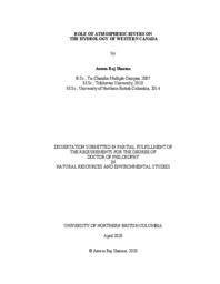
Atmospheric rivers (ARs) are synoptic-scale atmospheric phenomena that transport moisture from the (sub)-tropical regions to the mid-latitudes globally. They play a substantial role on water resources of British Columbia and southeastern Alaska (BCSAK). However, understanding of their climatology and impacts on the hydrology of this region remains limited. I use a combination of a regional AR catalog, reanalysis datasets, gridded precipitation, observed river runoff data, and topographic information, to provide insights on the climatology of landfalling ARs (LARs) and to quantify changes in the contribution of LARs to the precipitation, river runoff, and their extremes in BCSAK. Each year BCSAK experiences, on average, 35±5 LARs with the highest number in autumn (13±2) and an average duration of 2±1.8 days. The 1979-2016 average annual counts of LARs increase by ~20% across BCSAK. Slightly higher numbers of LARs occur during the neutral phase of El Niño-Southern Oscillation, the positive phases of the Pacific Decadal Oscillation and the Pacific-North American Pattern, and the 2013/2014 warm anomaly of the Northeastern Pacific. LARs contribute 13% (spatial range: <5-33%) and 36% (spatial range: <5-97%) of annual total and extreme precipitation, respectively, across BCSAK with higher values over elevated terrain. AR-related precipitation days increase during 1979-2012; however, no change occurs in the average AR-related precipitation amount for most of BCSAK. LARs contribute 14±6% (spatial range: 2%-29%) and 48±24% (spatial range: ~10%-100%) of the total annual and annual maxima runoff in the watersheds of BCSAK. ARs control the distribution of peak runoff in most of BCSAK with >60% of the 168 watersheds analyzed having >5 of the top 10 annual maxima runoff associated with them. My work presents a baseline assessment of the AR regional climatology in BCSAK, provides the proportion of hydrological processes attributed to ARs, and assesses changes in those linkages over time. This work is useful to associate future climate model simulations, extreme weather forecasting, seasonal predictions, and water issues including flood mitigation, hydro-power generation, industrial water use, and ecological, recreational, and cultural water values of western Canada where rapid climate-induced hydrological changes are occurring.
Origin Information
Content type
Digital Document
Description / Synopsis
Hudson Bay, a vast inland sea in northern Canada, receives the highest average annual freshwater from the Nelson River system among all other contributing rivers. A rapidly changing climate and flow regulation from hydroelectric developments alter Nelson River streamflows timing and magnitude, affecting Hudson Bay’s physical, biological, and biogeochemical state. Despite recent developments and advances in climate datasets, hydrological models, and computational power, modelling the Hudson Bay system remains particularly challenging. Therefore, this dissertation addresses crucial research questions from the Hudson Bay System (BaySys) project by informing how climate change impacts variability and trends of freshwater-marine coupling in Hudson Bay. To that end, I present a comprehensive intercomparison of available climate datasets, their performance, and application within the macroscale Variable Infiltration Capacity (VIC) model, over the Lower Nelson River Basin (LNRB). This work aims to identify the VIC parameters sensitivity and uncertainty in water balance estimations and investigates future warming impacts on soil thermal regimes and hydrology in the LNRB. An intercomparison of six climate datasets and their equally weighted mean reveals generally consistent air temperature climatologies and trends (1981–2010) but with a prominent disagreement in annual precipitation trends with exceptional wetting trends in reanalysis products. VIC simulations forced by these datasets are utilized to examine parameter sensitivity and uncertainties due to input data and model parameters. Findings suggest that infiltration and prescribed soil depth parameters show prevailing seasonal and annual impacts, among other VIC parameters across the LNRB. Further, VIC simulations (1981–2070) reveal historical and possible future climate change impacts on cold regions hydrology and soil thermal conditions across the study domain. Results suggest that, in the projected climate, soil temperature warming induces increasing baseflows as future warming may intensify infiltration processes across the LNRB. This dissertation reports essential findings in the application of state-of-the-art climate data and the VIC model to explore potential changes in hydrology across the LNRB’s permafrost gradient with industrial relevance of future water management, hydroelectric generation, infrastructure development, operations, optimization, and implementation of adaptation measures for current and future developments.
Origin Information
Content type
Digital Document
Description / Synopsis
Wind resources are investigated and estimated offshore of the northern and central coasts of British Columbia, Canada. Remote sensing-based wind speed observations from a Synthetic Aperture Radar (SAR) mounted on the Canadian RADARSAT-2 satellite are used for mapping offshore winds. In addition, in-situ wind speed observations extracted from several buoys distributed in the study region are used to analyze the temporal and spatial wind speed variations in relation to wind power generation. Sustained winds above several wind turbine thresholds are analyzed and values of 50-yr and 100-yr return extreme wind speed levels are calculated. The wind variability analysis suggests few interruptions to power generation by either very low wind speeds or extreme wind speed events with high spatial variability between offshore areas and sites located within the coastal mountains. The SAR wind speed fields are characterized by a high spatial resolution but cover a period of less than 2.5 years with a random temporal availability. The SAR fields are extrapolated to reanalysis long-term wind fields that are available over a climatological time period with a sub-daily temporal resolution but a coarse spatial resolution. The extrapolation procedure is developed by applying a statistical downscaling model and a bias-based correction method. Wind fields from both methods are validated against the in-situ observations from buoys. The extrapolated wind fields are used for mapping offshore winds by creating a robust wind climatology that represents the mesoscale wind variance as well as the diurnal wind variability. This wind climatology is used to calculate the wind statistics and power density, in addition to estimate offshore wind resources. Viable areas for wind power development are defined by using high resolution bathymetric data and considering the general environmental and ecological constraints in the region. The estimated offshore wind resource energy using only theiv determined viable areas is found to resemble a large portion of the current total power generation in British Columbia. Most suitable areas for offshore wind farms are determined by developing criteria based on a combination of the turbine tower technology, water depth zoning and power density values.
Origin Information
Content type
Digital Document
Description / Synopsis
Tracking the effects of air pollution from industries is important for developing management strategies under changing emissions. However, computational tools for air pollution assessment often do not elucidate modeling uncertainty, making it difficult for environmental policy-makers to know how much confidence to put in model results, which also hampers aspects that may need improving. This study examined how the WRF-SMOKE-CMAQ modeling system with various planetary boundary-layer (PBL) schemes and atmospheric datasets mimics the local meteorology, air quality and acidic deposition at 1 km horizontal resolution over the industrializing Terrace-Kitimat Valley of northwestern British Columbia. Quantitative and qualitative correspondence of model outputs with observational data varied with station location, the nature of pollutant emissions, and quantity of chemical species. Valid model outputs were used to delineate present compliance with objectives on ambient fine particulate matter, and baseline exceedance of critical loads of sulfur and nitrogen deposition for the forest ecosystem. Spatial impacts of anticipated industrial emissions on the environment were also assessed. An additional 15 tonnes day-1 permissible SO2 emission from an aluminum smelter in Kitimat was projected to result in 50–88 % increase in aerial exceedance of the limit for protection of lichen, and 37–67 % increase in spatial exceedance of acidic deposition to soils. Cumulatively, 16–18 km2 of plant habitat, and 10–11 km2 of soil in an area contiguous with the smelter site will likely be damaged by its SO2 emission under the latest regulation. Should two Liquefied Natural Gas projects commence operations, cumulative NOx concentrations are expected to remain below harmful levels, while pre-existing areal exceedance of nitrogen deposition will barely increase (0–1 km2). An additional 4 km2 area will be exposed to SO2 concentrationsiii that are directly harmful to vegetation, while 13–14 km2 total area with an average of 29.7–35.0 kg ha-1 yr-1 excess sulfur deposition was estimated. These projections assumed all future emissions of NOx, SO2 and other air pollutants will be from elevated point sources.
Origin Information
Content type
Digital Document
Description / Synopsis
My dissertation investigates glacier mass change in the Columbia and Rocky Mountains of British Columbia. In chapter one I discuss the importance of the cryosphere and glaciers, introduce the climate and glaciers of the study region, and outline the objectives and structure of this dissertation. Previous work established the feasibility of geodetic methods to accurately produce winter glacier mass balance and annual glacier mass balance. These studies demonstrate that geodetic surveys can be used to estimate mass balance during the accumulation season or for one glacier over a number of years. In chapter two, I refine these published methods to measure seasonal and annual mass balance for six glaciers within two mountain ranges from 2014–2018. I use synchronous field-based glaciological measurements, airbornelaser scanningsurveys (ALS) and satelliteimagery to quantify seasonal glacier mass change from 2014–2018. Chapter three reports on radar surveys I completed of the study glaciers, adding important observations to the global database of ice thickness. I use these observations and an existing flowline model, driven with observations of surface mass balance and glacier elevation to bias-correct ice thickness estimates for each glacier. Finally, I use the model to estimate ice thickness for all glaciers in the Columbia Basin and estimate total ice volume. Chapter four builds upon previous work which used surface topography, glacier mass balance, ice thickness, and ice velocity data to estimate ice flux at discrete glacier cross-sections. Previous efforts to infer the spatial distribution of mass balance have focused on glacier tongues. I expand upon this method, calculating surface mass balance between flux gates over the entire elevation range of three glaciers, over three years. I derive the altitude-mass balance relation and demonstrate that the relation can be accurately described with high-resolution elevation and ice flux data, and suggest that this method can be expanded for large-scale estimates. Chapter five summarizes the study’s major findings, highlights its limitations and discussed its broader implications. Finally, I make recommendations that will address knowledge gaps, and improve our understanding of changing glacier conditions and ability to model glacier dynamics.
Origin Information
Content type
Digital Document
Description / Synopsis
Seasonal snow-cover (SSC) substantially alters surface physical properties over the Northern Hemisphere (NH). It modulates processes within the energy and water cycles, thereby influencing climatology, hydrology, geomorphology and ecology. In spring and summer, snowmelt provides an essential resource for humankind. The identification, quantification and explanation of changing spatial and temporal distributions of SSC helps to predict future impacts on natural and human environments, and informs development of mitigation and adaptation strategies. Because SSC is spatially and temporally heterogeneous, meaningful estimation of trends in its distribution and duration is dependent on long records of remotely-sensed imagery. The Rutgers University Global Snow Laboratory and the United States’ National Oceanic and Atmospheric Administration provide the longest such archive (NOAA-Rutgers Snow Archive, NRSA), dating from 1966. However, several studies have raised questions about the credibility of the signs and magnitudes of trends derived from the NRSA, suggesting that they may be artifacts of technological improvements introduced in 1999. This dissertation improves the spatial resolution at which NH SSC extent and duration trends during the NRSA’s longest continuous section (since 1971) are reported, building on previous hemispheric and continental studies. It demonstrates that the magnitudes of area-related trends are sensitive to assumptions adopted when estimating SSC extent from the NRSA, and that these sensitivities vary spatially. The study assesses whether temporal trajectories of SSConset trends imply abrupt changes in 1999, particularly over more complex terrain, and finds no evidence of this. It also explores the broader climatological contexts of these trends, together with estimated departures from mean conditions. Evidence is presented at monthly intervals for causative chains linking advection of mid-tropospheric warming from lower to higher latitudes, consequent inception of climatologically novel airflows, and the incidence of significant SSConset trends of both signs. Earlier onset of snow-dominated conditions is found to be driven by augmented moisture advected from lower latitudes (in eastern Eurasia) or zonally from oceanic sources (in North America) over regional monthly mean 0°C isotherms. Delayed onset is associated with drier or warmer airflows. These findings support the interpretation that the NRSA-based trends are plausible within their spatial and temporal contexts.
Origin Information
Content type
Digital Document
Description / Synopsis
Intermontane lakes are often enclosed by complex topography that creates difficulty in resolving the local and regional wind fields. Quesnel Lake, nestled into the western flank of the Cariboo Mountains in central British Columbia, is one such lake. This study examines the wind climatology of Quesnel Lake at three distinct spatial and temporal scales. Firstly, long-term wind data from meteorological stations bordering the Cariboo Mountains exhibit a cycle of calm and active periods throughout the year. Secondly, an environmentto- circulation synoptic climatology is presented that illustrates the large-scale atmospheric patterns that lead to strong wind events at the lake. Finally, the spatial and temporal variability of the near-surface wind field has been examined using an array of shore-based meteorological stations. The response of the wind field to synoptic forcing is found to be driven primarily by the orientation of the regional 800 hPa pressure gradient. iii
Origin Information
Content type
Digital Document
Origin Information
Content type
Digital Document
Origin Information
Content type
Digital Document
Origin Information
Content type
Digital Document
Origin Information
Content type
Digital Document
Origin Information
Content type
Digital Document
Origin Information
Content type
Digital Document
Origin Information
Content type
Digital Document
Origin Information
Content type
Digital Document
Origin Information
Content type
Digital Document
Origin Information

