Wheate, Roger
Person Preferred Name
Roger Wheate
Related Works
Content type
Digital Document
Origin Information
Content type
Digital Document
Origin Information
Content type
Digital Document
Description / Synopsis
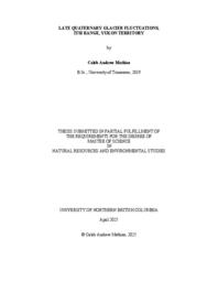
The aim of this dissertation is to investigate and quantify biophysical diversity on landslides in the boreal forest of the Peace River Region of northern British Columbia (BC), sampling three landslides that occurred in the last 50 years. Landslides are increasing in the boreal forest, likely driven by climate changes such as increased precipitation and permafrost thaw, and as a derivative of large wildfires. An understanding of ecosystem recovery on landslides is important for conservation and management purposes. Several studies have been done in southern parts of the world to elucidate processes of landslide recovery. However, few studies have addressed landslide recovery in northern climates, and little is known about the biophysical diversity of landslides in this region. This research investigates whether landslides are more biophysically diverse than the surrounding relatively undisturbed terrain, and whether microsite variables or geomorphic diversity are predictors of plant community diversity. Using a series of field sampling campaigns and GIS (geographic information system) mapping exercises, I show that landslides are more biophysically diverse than the surrounding terrain in some respects, while the surrounding undisturbed terrain is more diverse in other aspects. The age and size of landslides also appear to influence diversity. Microsite diversity does not necessarily predict plant diversity. The research highlights the role of invasive plant species in slope stabilisation and plant community makeup. I also show that landslide ponds are disproportionately concentrated on rotational landslides, and that most ponds on landslides occur in the body and toe. I note post-slide modifications such as drainage of landslide ponds and lowering of landslide ridges, but many geomorphic features are expected to endure for decades to millennia. Overall, the research shows that vegetation recovery is complex and may take decades to fully manifest. This study contributes knowledge about plant community and site diversity on landslides by providing quantitative data and comparing those traits with those found on surrounding terrain. These findings can be used as guidance when identifying conservation and management practices for ecological restoration of disturbed slopes.
Origin Information
Content type
Digital Document
Description / Synopsis
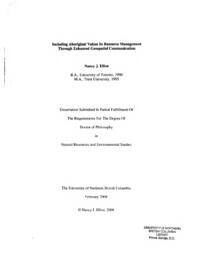
Industrial land-use has had profound impacts on Indigenous peoples’ homelands throughout Canada. Over the last century, logging practices in British Columbia have severed peoples’ connections to the land-base, creating access challenges and disrupting the availability of important plant resources. Devil’s club (Oplopanax horridus) is an important medicinal plant to communities in northwestern British Columbia, and there are mounting concerns about the impacts of logging on this ethnobotanically salient species. Over the last 70 years, swathes of productive forests throughout Gitxsan homelands have been impacted by the logging industry. Wilp (house) Luutkudziiwus has seen ~12% of their territory of Madii Lii altered by industrial-scale clearcut logging, which has left a mosaic of even-aged cutblocks that have potentially altered devil’s club habitat. To investigate and detail the potential impacts of logging on devil’s club in Madii Lii territory, this research measured devil’s club health and vigour across a chrono-sequence of clearcut-logged sites compared with traditionally managed and unlogged sites in the territory. In addition, Species Distribution Models in conjunction with two different climate change scenarios (SSP245 moderate GHGs and SSP585 high GHGs) were used to predict habitat suitability for devil’s club in Madii Lii and throughout British Columbia to the end of the 21st century. Results suggest that, compared to traditionally managed areas (and controls), extensive logging in the territory negatively impacted the health and vigour of devil’s club, especially the most desirable individuals (with the largest and thickest stems). In addition, the predictive modelling for both climate scenarios suggest that climate change will increasingly impact highquality devil’s club habitat.
Origin Information
Content type
Digital Document
Description / Synopsis
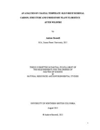
I assessed some coastal temperature old-growth forests of southwestern British Columbia to understand their post-wildfire structure, carbon storage and biodiversity values. I used a remotely sensed relativized burn ratio and a composite burn index to compare measures of aboveground carbon, structural complexity and floristic diversity between burned and unburned reference plots years after four large wildfires. The unburned reference plots represented the natural range of variation of old growth values. In burned plots, 21 of 60 retained carbon values and 10 plots retained structural values similar to unburned old growth plots. There was an average of 12% floristic similarity between burned and unburned understory plant communities. For land managers, this method offers a way to compare old-growth values after wildfire in order to prioritize protection, salvage, and restoration options.
Origin Information
Content type
Digital Document
Description / Synopsis
Remote sensing techniques have been demonstrated to be efficient tools for producing reliable and accurate information regarding forest inventory. Airborne Laser Scanning (ALS) can be used to develop Predictive Ecosystem Mapping (PEM) models based on Digital Elevation Model (DEM) derived layers. These PEM models, and the variables that they are based on may be used to generate reliable information to predict forest growth potential using an age-independent approach. This study evaluated the efficacy of using ALS-derived attributes to infer Site Index (SI) in plantation areas up to 30 years old, and compares the results with the current Biogeoclimatic Ecosystem Classification (BEC) estimates. I used a machine learning approach and Random Forest techniques to develop an age-independent SI model (SI_pem) incorporating DEM-derived topographic layers. The resulting SI_pem model produces accurate SI estimates at a fine grain across different forest ecosystems. The model performed significantly better when compared to Site Index by Biogeoclimatic Ecosystem Classification site series (SIBEC) lookup tables. Microclimate variables associated with water process, such as Topographic Positioning Index, Diurnal Anisotropic Heating, Topographic Openness Dominance and Overland Flow Horizontal Distance had significant importance to predict SI across the three areas studied in this work.
Origin Information
Content type
Digital Document
Description / Synopsis
The three western Canadian provinces (British Columbia, Alberta and Saskatchewan) are responsible for more than 90 % of the 2017 national total fugitive methane (CH4) emissions from the oil and gas sector. Several survey-based previous studies demonstrated that government estimated CH4 emissions from western Canada’s oil and gas sector are significantly underestimated due to large methodological uncertainties. Most of these survey-based studies were conducted for a limited number of days in a small area; scaling up the short-term results over a larger area for the whole year might lead to emission estimation errors. However, accurate quantification is required to inform effective emission reduction policies in Canada. To improve our understanding of CH4 emissions from the oil and gas sector in western Canada, this Ph.D work has addressed the above problem by using a combination of long-term satellite XCH4 data sets (SCIAMACHY and GOSAT; 2003-2017) and NOAA/ESRL aircraft CH4 measurements, as well as GEOS-Chem CH4 simulation (2010-2017). The overall XCH4 enhancement trend was found to be 6.71 ±4.84 %/yr in western Canada during 2009-2017, which is likely influenced by local oil and gas development activities. The oil and gas CH4 emissions estimation using an ensemble of GOSAT XCH4 data products in a mass balance method demonstrated a fluctuating pattern of emissions in these three provinces during 2009-2017, largely due to diminished oil and gas development activities particularly during 2014-2016. The satellite-based estimated oil and gas CH4 emissions in British Columbia and Saskatchewan are higher than the government inventory by ~200 %, but only higher by ~50 % in Alberta. Although the GOSAT products are suitable for quick and reasonably accurate annual CH4 emissions quantification in western Canada, the GOSAT product is limited in its ability to detect monthly emissions, which is required considering the seasonality of CH4 emissions from major sources. Therefore, further studies particularly with TROPOMI is strongly suggested. Furthermore, the GEOS-Chem based numerical experiments identified emissions from major sources such as wetlands and oil and gas sector are spatially overlapped in the oil and gas dominated areas, particularly during summer, suggesting further oil and gas CH4 emission studies should be carefully conducted.
Origin Information
Content type
Digital Document
Description / Synopsis
Glaciers hold 1.7% of the Earth's total water supply, but they contain 68.7% of its freshwater. Given the global warming trend, accurate and recent inventory is necessary to assess glacial changes over time. However, frequent cloud and debris cover often make it difficult to determine the glacier's exact edge. Multispectral Landsat 8 imagery along with data from the Global Land Ice Velocity Extraction (GoLIVE) project are combined to to create a Bayesian multivariate general additive model of the glaciers surrounding Mount Rainier, with Autoregressive Moving Average (ARMA) and Gaussian processes used to model the temporal and spatial autocorrelations. Using root mean square error and Watanabe-Akaike information criterion, all 42 combinations of ARMA models up to 4 total parameters and exponential, Matérn 1/2 and spherical covariance kernels were compared. The ARMA(3,1) processes with the exponential Gaussian process kernel was determined to be the best fit model. Gaussian mixture models, hierarchical clustering, hard and soft K-means clustering, and support vector machines are used to classify the posterior distribution. The hard K-means algorithm was the best classifier, and it accurately predicted 85.1% of the glaciers, compared to 68.8% from a univariate classification on the Red/SWIR band ratio.
Origin Information
Content type
Digital Document
Description / Synopsis
Forest management in the central interior of British Columbia has been active for over a century. Industrial forest practices in the region are based on the premise that harvest and subsequent stands regeneration is sustainable, but recent investigations raise questions about long-term ecological sustainability and impacts on biodiversity. I evaluate here, using a chronosequence of forest stands, the impacts of stand harvest on biodiversity status and recovery. Aerial laser scanning is used to enhance analysis and model impacts spatially. I provide a novel assessment of key biodiversity metrics of diversity, richness, abundance, and modeling using linear discriminant analysis and random forest frameworks. Results show that vegetation community composition and coarse woody debris (CWD), a key habitat for numerous taxa, are both impacted by harvest history. Predictive mapping of CWD provides insights and a further tool for decision makers to manage and ensure natural levels of CWD are maintained on the landscape.
Origin Information
Content type
Digital Document
Description / Synopsis
The synergistic effects of anthropogenic disturbance, habitat fragmentation and climate change pose a significant threat to biodiversity that is challenging to predict. Anthropogenically driven climate change has already begun to impact critical climate regions and is now recognized to be one of the most serious threats to biodiversity and the conservation thereof. Despite this, few conservation planning initiatives have sought to sharpen the focus of the systematic conservation planning (SCP) framework to explicitly include climate change. To promote the evolution of the SCP framework into a climate change-conscious (CCC) approach to conservation planning, I developed and applied a methodology for incorporating climatechange resiliency into the SCP framework. This CCC-SCP methodology can be used to guide future conservation planning initiatives, helping conservation planners recognize and respond to opportunities for action, conserve our planet’s biodiversity and mitigate the effects of climate change.
Origin Information
Content type
Digital Document
Origin Information
Content type
Digital Document
Description / Synopsis
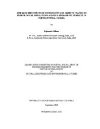
Hudson Bay, a vast inland sea in northern Canada, receives the highest average annual freshwater from the Nelson River system among all other contributing rivers. A rapidly changing climate and flow regulation from hydroelectric developments alter Nelson River streamflows timing and magnitude, affecting Hudson Bay’s physical, biological, and biogeochemical state. Despite recent developments and advances in climate datasets, hydrological models, and computational power, modelling the Hudson Bay system remains particularly challenging. Therefore, this dissertation addresses crucial research questions from the Hudson Bay System (BaySys) project by informing how climate change impacts variability and trends of freshwater-marine coupling in Hudson Bay. To that end, I present a comprehensive intercomparison of available climate datasets, their performance, and application within the macroscale Variable Infiltration Capacity (VIC) model, over the Lower Nelson River Basin (LNRB). This work aims to identify the VIC parameters sensitivity and uncertainty in water balance estimations and investigates future warming impacts on soil thermal regimes and hydrology in the LNRB. An intercomparison of six climate datasets and their equally weighted mean reveals generally consistent air temperature climatologies and trends (1981–2010) but with a prominent disagreement in annual precipitation trends with exceptional wetting trends in reanalysis products. VIC simulations forced by these datasets are utilized to examine parameter sensitivity and uncertainties due to input data and model parameters. Findings suggest that infiltration and prescribed soil depth parameters show prevailing seasonal and annual impacts, among other VIC parameters across the LNRB. Further, VIC simulations (1981–2070) reveal historical and possible future climate change impacts on cold regions hydrology and soil thermal conditions across the study domain. Results suggest that, in the projected climate, soil temperature warming induces increasing baseflows as future warming may intensify infiltration processes across the LNRB. This dissertation reports essential findings in the application of state-of-the-art climate data and the VIC model to explore potential changes in hydrology across the LNRB’s permafrost gradient with industrial relevance of future water management, hydroelectric generation, infrastructure development, operations, optimization, and implementation of adaptation measures for current and future developments.
Origin Information
Content type
Digital Document
Description / Synopsis
Methods for cumulative threat mapping, such as the human footprint, have been rapidly developing to inform the management of biodiversity and ecosystem services. Here, I perform the first comprehensive literature review establishing what methods are used, what threats are mapped and where, and if threats or impacts are mapped statically or dynamically in time. From knowledge gained in the review, I compiled geospatial datasets in a geographic information system to map the first Canadian human footprint. Subsequently, I answer where the most intact and heavily threatened areas are, what the most prevalent threats in Canada are and assess the accuracy of the data through a technical validation. This thesis contributes to conservation science by highlighting where regional studies are lacking, which threats are not being captured, providing examples of how studies have managed dynamic timescales and mapped through to impacts, and provides key information for future conservation in Canada.
Origin Information
Content type
Digital Document
Description / Synopsis
My dissertation investigates glacier mass change in the Columbia and Rocky Mountains of British Columbia. In chapter one I discuss the importance of the cryosphere and glaciers, introduce the climate and glaciers of the study region, and outline the objectives and structure of this dissertation. Previous work established the feasibility of geodetic methods to accurately produce winter glacier mass balance and annual glacier mass balance. These studies demonstrate that geodetic surveys can be used to estimate mass balance during the accumulation season or for one glacier over a number of years. In chapter two, I refine these published methods to measure seasonal and annual mass balance for six glaciers within two mountain ranges from 2014–2018. I use synchronous field-based glaciological measurements, airbornelaser scanningsurveys (ALS) and satelliteimagery to quantify seasonal glacier mass change from 2014–2018. Chapter three reports on radar surveys I completed of the study glaciers, adding important observations to the global database of ice thickness. I use these observations and an existing flowline model, driven with observations of surface mass balance and glacier elevation to bias-correct ice thickness estimates for each glacier. Finally, I use the model to estimate ice thickness for all glaciers in the Columbia Basin and estimate total ice volume. Chapter four builds upon previous work which used surface topography, glacier mass balance, ice thickness, and ice velocity data to estimate ice flux at discrete glacier cross-sections. Previous efforts to infer the spatial distribution of mass balance have focused on glacier tongues. I expand upon this method, calculating surface mass balance between flux gates over the entire elevation range of three glaciers, over three years. I derive the altitude-mass balance relation and demonstrate that the relation can be accurately described with high-resolution elevation and ice flux data, and suggest that this method can be expanded for large-scale estimates. Chapter five summarizes the study’s major findings, highlights its limitations and discussed its broader implications. Finally, I make recommendations that will address knowledge gaps, and improve our understanding of changing glacier conditions and ability to model glacier dynamics.
Origin Information
Content type
Digital Document
Description / Synopsis
A proposed hybrid lateral load resisting system combining a moderately ductile steel moment resisting frame (SMRF) with Cross-laminated Timber (CLT) balloon-framed shear walls is investigated on 8, 12 and 16-storey case-study buildings using equivalent static, linear dynamic (modal), nonlinear static (push-over) and nonlinear dynamic (time history) analyses. First, a SMRF is designed using ETABS, then the hybrid structures are analysed in OpenSees. By adding the CLT shear wall to steel moment frame, the period of structure decreased and its stiffness increased. The time history analyses result revealed that by adding the CLT shear wall the maximum drift decreased, while the maximum base shear in hybrid structure slightly increased. The hold down uplift forces under earthquake records are reported and compared to each other. Using push-over capacity-curves, a ductility reduction factor of 3.6, an over strength factor of 1.57 and a seismic response modification factor of 5.67 are derived.
Origin Information
Content type
Digital Document
Description / Synopsis
Old-growth forest reserves offer the potential to facilitate the maintenance of multiple ecosystem services (ES), such as carbon storage, water and recreation, in managed landscapes. However, substantial challenges exist with regard to defining and identifying old-growth forests, and suitably locating priority areas for old-growth conservation. To address these issues, I developed a structure-based old-growth index using field and LiDAR metrics that allowed old-growth values to be estimated at a fine grain across a landscape. I then used a spatial prioritization tool to simulate old-growth reserves for multiple ESs. Using this framework I evaluated trade-offs between forest ESs including timber. This thesis contributes to the management of old-growth forests by providing a quantitative and repeatable framework to identify, assess and monitor old-growth values while indicating the scope for the establishment of old-growth reserves for multiple ESs.
Origin Information
Content type
Digital Document
Description / Synopsis
Seasonal snow-cover (SSC) substantially alters surface physical properties over the Northern Hemisphere (NH). It modulates processes within the energy and water cycles, thereby influencing climatology, hydrology, geomorphology and ecology. In spring and summer, snowmelt provides an essential resource for humankind. The identification, quantification and explanation of changing spatial and temporal distributions of SSC helps to predict future impacts on natural and human environments, and informs development of mitigation and adaptation strategies. Because SSC is spatially and temporally heterogeneous, meaningful estimation of trends in its distribution and duration is dependent on long records of remotely-sensed imagery. The Rutgers University Global Snow Laboratory and the United States’ National Oceanic and Atmospheric Administration provide the longest such archive (NOAA-Rutgers Snow Archive, NRSA), dating from 1966. However, several studies have raised questions about the credibility of the signs and magnitudes of trends derived from the NRSA, suggesting that they may be artifacts of technological improvements introduced in 1999. This dissertation improves the spatial resolution at which NH SSC extent and duration trends during the NRSA’s longest continuous section (since 1971) are reported, building on previous hemispheric and continental studies. It demonstrates that the magnitudes of area-related trends are sensitive to assumptions adopted when estimating SSC extent from the NRSA, and that these sensitivities vary spatially. The study assesses whether temporal trajectories of SSConset trends imply abrupt changes in 1999, particularly over more complex terrain, and finds no evidence of this. It also explores the broader climatological contexts of these trends, together with estimated departures from mean conditions. Evidence is presented at monthly intervals for causative chains linking advection of mid-tropospheric warming from lower to higher latitudes, consequent inception of climatologically novel airflows, and the incidence of significant SSConset trends of both signs. Earlier onset of snow-dominated conditions is found to be driven by augmented moisture advected from lower latitudes (in eastern Eurasia) or zonally from oceanic sources (in North America) over regional monthly mean 0°C isotherms. Delayed onset is associated with drier or warmer airflows. These findings support the interpretation that the NRSA-based trends are plausible within their spatial and temporal contexts.
Origin Information
Content type
Digital Document
Description / Synopsis
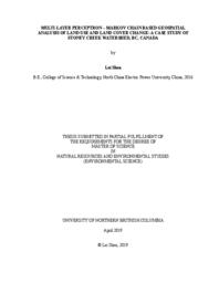
This thesis study analyzed the land use and land cover (LULC) changes in Stoney Creek Watershed, BC, Canada using the combination of remote sensing, GIS and modeling approaches. The Object-Based Image Analysis (OBIA) tool in PCI Geomatica 2017 software was applied to generate unsupervised classification LULC maps using Landsat TM and OLI images of the years 1986, 1999 and 2016. Various band ratio were computed to improve different classification results. Esri ArcMap 10.5 was used to produce all the LULC maps for subsequent modeling. A modeling method using Multi-layer perceptron (MLP) neural network and Markov Chain (MC) was performed to predict LULC changes in 2026, using hard and soft prediction results. The outcomes of this study could provide valuable information of LULC patterns and dynamics for supporting both environmental and economic development in this area.
Origin Information
Content type
Digital Document
Origin Information
Content type
Digital Document
Origin Information
Content type
Digital Document
Origin Information
Content type
Digital Document
Origin Information
Content type
Digital Document
Origin Information
Content type
Digital Document
Origin Information
Content type
Digital Document
Origin Information

