Menounos, Brian
Person Preferred Name
Brian Menounos
Related Works
Content type
Digital Document
Origin Information
Content type
Digital Document
Origin Information
Content type
Digital Document
Origin Information
Content type
Digital Document
Description / Synopsis
This research aims to enhance scholarly understanding of snow dynamics, the remotely sensed snowpacks, and the calculation of basin-wide snow water equivalent in mountainous terrain. Mountain snow is a critical source of meltwater. However, forecasting snow distributions and total water equivalence in mountain basins is limited due to complex terrain, challenging environmental conditions, and lack of observations. Laser altimetry can provide detailed observations of snow depth, but an estimate of snow density is required to evaluate the total basin water equivalence. This study uses laser altimetry surveys and empirically modelled snow densities to estimate mountainous basin-wide snow-water equivalent (SWE). Between 2017 and 2020, seven laser altimeter surveys during late winter and spring were conducted in the LaJoie Basin, Coast Mountains, British Columbia (B.C.), a strategic hydroelectric power reservoir. The laser-derived snow depths averaged between 1.4 and 2.1 m for non-glacierized terrain, while glacierized terrain weighted averages ranged between 2.2 and 5.4 m. The laser-derived depths were combined with empirical snow density models to derive distributed SWE for the Lajoie Basin. Ten linear and three non-linear snow density empirical models were tested and developed, from which (a) a snow course multi-parameter, non-linear relation and (b) snow pillow robust (Huber loss) linear regressions yielded this study’s lowest root mean squared errors (51.65 and 74.12 kg m-3, respectively). For non-glacierized terrain, the multi-parameter, non-linear model produced basin-wide SWE averages between 0.56 and 1.06 m.w.e. and propagated uncertainties from ± 0.1 to ± 0.14 m.w.e. Conversely, glacierized terrain exhibited weighted SWE averages between 0.82 and 2.93 m.w.e., with estimates of uncertainty ranging from ± 0.31 to ± 0.52 m.w.e. The robust linear regressions yielded non-glacierized SWE averages from 0.49 to 0.92 m.w.e., with uncertainties between ± 0.14 and ± 0.2 m.w.e. The weighted SWE averages in glacierized terrain ranged between 0.77 and 1.92 m.w.e., with estimates of uncertainty between ± 0.29 and ± 0.45 m.w.e. The SWE estimates from lidar and modelled density are comparable to snow pillow observations at the watershed, which demonstrates the effectiveness of these coupled techniques and improves our forecasting capabilities.
Origin Information
Content type
Digital Document
Description / Synopsis
My dissertation investigates late Pleistocene and Holocene glacier change in western Canada and is presented in five chapters. In chapter one, I discuss the importance of the cryosphere, the techniques used for reconstructing past glacier behavior, previous research that has contributed to our current understanding of past glacier change, and the objectives and structure of my dissertation. In chapter two, I complete a multi-proxy investigation of Holocene glacier change at Gilbert Glacier, in the Southern Coast mountains. I use radiocarbon dating of lateral moraine stratigraphy and cosmogenic nuclide surface exposure dating to constrain the timing and duration of late Holocene advances at Gilbert Glacier to 2.0–1.8, ~1.5–1.3, ~0.9–0.8, and 0.4–0.1 ka. Organic matter associated with glacier advance within the north-lateral moraine at Gilbert Glacier records advances at 4.8–4.6, 4.5–4.3, 4.0–3.9, 3.8–3.6, 3.4, 3.2–2.9, 2.7, and 0.5–0.3 kilo calendar years BP (ka; 2-sigma age range). I advocate for the tandem use of multiple glacial geochronologic tools to better constrain the onset and termination of glacier advances. Chapter three applies cosmogenic surface exposure dating to a previously understudied region in the Mackenzie and Selwyn mountains of the eastern Yukon and Northwest Territories to develop a late Holocene glacier chronology. Surface exposure ages from 27 moraine boulders across nine glaciers show that glaciers reached their greatest Holocene extent between 1600-1850 CE. I use this glacier chronology to tune a glacier model forced by models of past climate to estimate regional changes in ice volume over the past millennium. Additionally, I use the same glacier model to estimate that glaciers in the region will decline in ice volume by 85% - 97% by 2100 CE. Chapter four returns to the southern Coast mountains where I use cosmogenic dating on moraine boulders, bedrock surfaces, and shallow bedrock cores to investigate the history of deglaciation and Holocene glacier behavior of a small cirque glacier. Bedrock surfaces within and outside of the late Holocene maximum extent of the glacier record complex burial and exposure histories. I employ a Monte Carlo approach to evaluate the most likely glacier history that can be explained by our data. I discuss how our results compare with the work of previous chapters and past research, and the limitations of this technique to constrain the many variables that impact surface exposure ages. Chapter five provides a summary of my study’s major findings and further discusses their limitations and broader implications. I conclude with recommendations for future research that will expand on the work presented in this dissertation.
Origin Information
Content type
Digital Document
Description / Synopsis
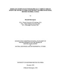
This dissertation investigates winter accumulation and snow cover change in the Columbia Mountains of British Columbia. In chapter 1, I start with an introduction that describes the study area, and then outlines the objectives and structure of this dissertation. In chapter 2, I examine the performance of two snow evolution models with different complexities (SnowModel and Alpine3D) at simulating winter glacier mass balance on four individual glaciers using two different forcing datasets, the Weather Research and Forecasting model (WRF) outputs and the North American Land Data Assimilation System (NLDAS). My results show that both models can simulate winter accumulation with less than 20% bias for each glacier, with SnowModel forced by WRF yielding the least overall bias. In chapter 3, I study the effect of wind on snow patterns to determine the impact of snow redistribution by wind in terms of erosion, deposition, and sublimation on winter mass balance estimation. The results demonstrate that modelled redistribution of snow by wind produces a visually realistic pattern of snow accumulation when compared to observed snow depth, but its impact on the glacier-averaged winter mass balance estimation is negligible (< 4%). The results also suggest that drifting snow sublimation is highly time and space dependent. Considering the model performance from previous chapters, in chapter 4, I analyzed the future snow cover change over the upper Columbia Basin under the Representative Concentration Pathway (RCP8.5) climate scenario by the end of the 21st century. I used downscaled climate projections of the Community Earth System Model (CESM1) by WRF, along with statistically downscaled data provided from the Pacific Climate Impacts Consortium (PCIC) to force SnowModel. The simulated snow maps represent a higher dynamically downscaled mean snow water equivalent (SWE) reduction – reaching up to 30% by the end of the century - than the statistically downscaled SWE reduction. While SWE reduction of more than 60% happens at lower and mid-elevations, altitudes higher than 2000 m are less vulnerable to climate change. I conclude this dissertation (Chapter 5) with a summary of the progress gained, study limitations, suggestions for future research, and research implications.
Origin Information
Content type
Digital Document
Description / Synopsis
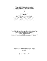
Atmospheric rivers (ARs) are synoptic-scale atmospheric phenomena that transport moisture from the (sub)-tropical regions to the mid-latitudes globally. They play a substantial role on water resources of British Columbia and southeastern Alaska (BCSAK). However, understanding of their climatology and impacts on the hydrology of this region remains limited. I use a combination of a regional AR catalog, reanalysis datasets, gridded precipitation, observed river runoff data, and topographic information, to provide insights on the climatology of landfalling ARs (LARs) and to quantify changes in the contribution of LARs to the precipitation, river runoff, and their extremes in BCSAK. Each year BCSAK experiences, on average, 35±5 LARs with the highest number in autumn (13±2) and an average duration of 2±1.8 days. The 1979-2016 average annual counts of LARs increase by ~20% across BCSAK. Slightly higher numbers of LARs occur during the neutral phase of El Niño-Southern Oscillation, the positive phases of the Pacific Decadal Oscillation and the Pacific-North American Pattern, and the 2013/2014 warm anomaly of the Northeastern Pacific. LARs contribute 13% (spatial range: <5-33%) and 36% (spatial range: <5-97%) of annual total and extreme precipitation, respectively, across BCSAK with higher values over elevated terrain. AR-related precipitation days increase during 1979-2012; however, no change occurs in the average AR-related precipitation amount for most of BCSAK. LARs contribute 14±6% (spatial range: 2%-29%) and 48±24% (spatial range: ~10%-100%) of the total annual and annual maxima runoff in the watersheds of BCSAK. ARs control the distribution of peak runoff in most of BCSAK with >60% of the 168 watersheds analyzed having >5 of the top 10 annual maxima runoff associated with them. My work presents a baseline assessment of the AR regional climatology in BCSAK, provides the proportion of hydrological processes attributed to ARs, and assesses changes in those linkages over time. This work is useful to associate future climate model simulations, extreme weather forecasting, seasonal predictions, and water issues including flood mitigation, hydro-power generation, industrial water use, and ecological, recreational, and cultural water values of western Canada where rapid climate-induced hydrological changes are occurring.
Origin Information
Content type
Digital Document
Description / Synopsis
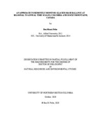
My dissertation investigates glacier mass change in the Columbia and Rocky Mountains of British Columbia. In chapter one I discuss the importance of the cryosphere and glaciers, introduce the climate and glaciers of the study region, and outline the objectives and structure of this dissertation. Previous work established the feasibility of geodetic methods to accurately produce winter glacier mass balance and annual glacier mass balance. These studies demonstrate that geodetic surveys can be used to estimate mass balance during the accumulation season or for one glacier over a number of years. In chapter two, I refine these published methods to measure seasonal and annual mass balance for six glaciers within two mountain ranges from 2014–2018. I use synchronous field-based glaciological measurements, airbornelaser scanningsurveys (ALS) and satelliteimagery to quantify seasonal glacier mass change from 2014–2018. Chapter three reports on radar surveys I completed of the study glaciers, adding important observations to the global database of ice thickness. I use these observations and an existing flowline model, driven with observations of surface mass balance and glacier elevation to bias-correct ice thickness estimates for each glacier. Finally, I use the model to estimate ice thickness for all glaciers in the Columbia Basin and estimate total ice volume. Chapter four builds upon previous work which used surface topography, glacier mass balance, ice thickness, and ice velocity data to estimate ice flux at discrete glacier cross-sections. Previous efforts to infer the spatial distribution of mass balance have focused on glacier tongues. I expand upon this method, calculating surface mass balance between flux gates over the entire elevation range of three glaciers, over three years. I derive the altitude-mass balance relation and demonstrate that the relation can be accurately described with high-resolution elevation and ice flux data, and suggest that this method can be expanded for large-scale estimates. Chapter five summarizes the study’s major findings, highlights its limitations and discussed its broader implications. Finally, I make recommendations that will address knowledge gaps, and improve our understanding of changing glacier conditions and ability to model glacier dynamics.
Origin Information
Content type
Digital Document
Description / Synopsis
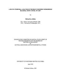
Seasonal snow-cover (SSC) substantially alters surface physical properties over the Northern Hemisphere (NH). It modulates processes within the energy and water cycles, thereby influencing climatology, hydrology, geomorphology and ecology. In spring and summer, snowmelt provides an essential resource for humankind. The identification, quantification and explanation of changing spatial and temporal distributions of SSC helps to predict future impacts on natural and human environments, and informs development of mitigation and adaptation strategies. Because SSC is spatially and temporally heterogeneous, meaningful estimation of trends in its distribution and duration is dependent on long records of remotely-sensed imagery. The Rutgers University Global Snow Laboratory and the United States’ National Oceanic and Atmospheric Administration provide the longest such archive (NOAA-Rutgers Snow Archive, NRSA), dating from 1966. However, several studies have raised questions about the credibility of the signs and magnitudes of trends derived from the NRSA, suggesting that they may be artifacts of technological improvements introduced in 1999. This dissertation improves the spatial resolution at which NH SSC extent and duration trends during the NRSA’s longest continuous section (since 1971) are reported, building on previous hemispheric and continental studies. It demonstrates that the magnitudes of area-related trends are sensitive to assumptions adopted when estimating SSC extent from the NRSA, and that these sensitivities vary spatially. The study assesses whether temporal trajectories of SSConset trends imply abrupt changes in 1999, particularly over more complex terrain, and finds no evidence of this. It also explores the broader climatological contexts of these trends, together with estimated departures from mean conditions. Evidence is presented at monthly intervals for causative chains linking advection of mid-tropospheric warming from lower to higher latitudes, consequent inception of climatologically novel airflows, and the incidence of significant SSConset trends of both signs. Earlier onset of snow-dominated conditions is found to be driven by augmented moisture advected from lower latitudes (in eastern Eurasia) or zonally from oceanic sources (in North America) over regional monthly mean 0°C isotherms. Delayed onset is associated with drier or warmer airflows. These findings support the interpretation that the NRSA-based trends are plausible within their spatial and temporal contexts.
Origin Information
Content type
Digital Document
Origin Information
Content type
Digital Document
Origin Information
Content type
Digital Document
Origin Information
Content type
Digital Document
Origin Information
Content type
Digital Document
Origin Information
Content type
Digital Document
Origin Information
Content type
Digital Document
Origin Information
Content type
Digital Document
Origin Information
Content type
Digital Document
Origin Information
Content type
Digital Document
Origin Information


