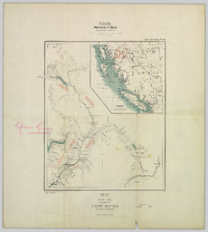
Summary Persons Persons Author (aut): McEvoy, James Collection(s) Collection(s) NBCDC Maps and Plans Origin Information Origin Information Place [Ottawa] Date Created/Date Issued 1912 Publisher Geological Survey Organizations Author (aut): Geological Survey of Canada Subjects and Classifications Subject Topic Subject Topic Geology -- British Columbia -- Nass River -- Maps. Geographic Subject Geographic Subject Nass River (B.C.)--Maps. Library of Congress Classification Library of Congress Classification G3512.N37 C51 1912 .M34 Resource Description Extent Extent 1 map : col. ; 33 x 27 cm., folded to 16 x 15 cm. Physical Form Physical Form map nonprojected graphic Content type Content type Image Resource Type Resource Type Still image Genre Genre map Language Language English Identifiers Handle Handle Handle placeholder Notes Note Note Type statement of responsibility Note surveys, J. McEvoy, 1893 ; C.O. Senecal, geographer and chief draughtsman. Access and Rights Use License Use License Public Domain Mark 1.0 Universal