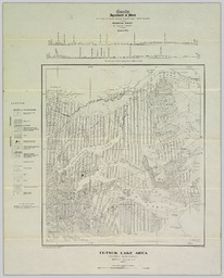
Summary Collection(s) Collection(s) NBCDC Maps and Plans Origin Information Origin Information Place Ottawa Date Created/Date Issued 1926 Publisher Department of Mines Organizations Author (aut): Geological Survey of Canada Author (aut): British Columbia Department of Lands Subjects and Classifications Subject Topic Subject Topic Eutsuk Lake Region (B.C.) -- Maps. Library of Congress Classification Library of Congress Classification G3400 s250 93 E 1926 Resource Description Extent Extent 1 map : col. ; on sheet 54 x 43 cm. Physical Form Physical Form map map Content type Content type Image Resource Type Resource Type Cartographic Genre Genre map Language Language English Identifiers Handle Handle Handle placeholder Notes Note Note Type statement of responsibility Note geology by J. R. Marshall ; geography from compilation by Department of Lands, British Columbia. Access and Rights Use and Reproduction Use and Reproduction http://creativecommons.org/publicdomain/mark/1.0/